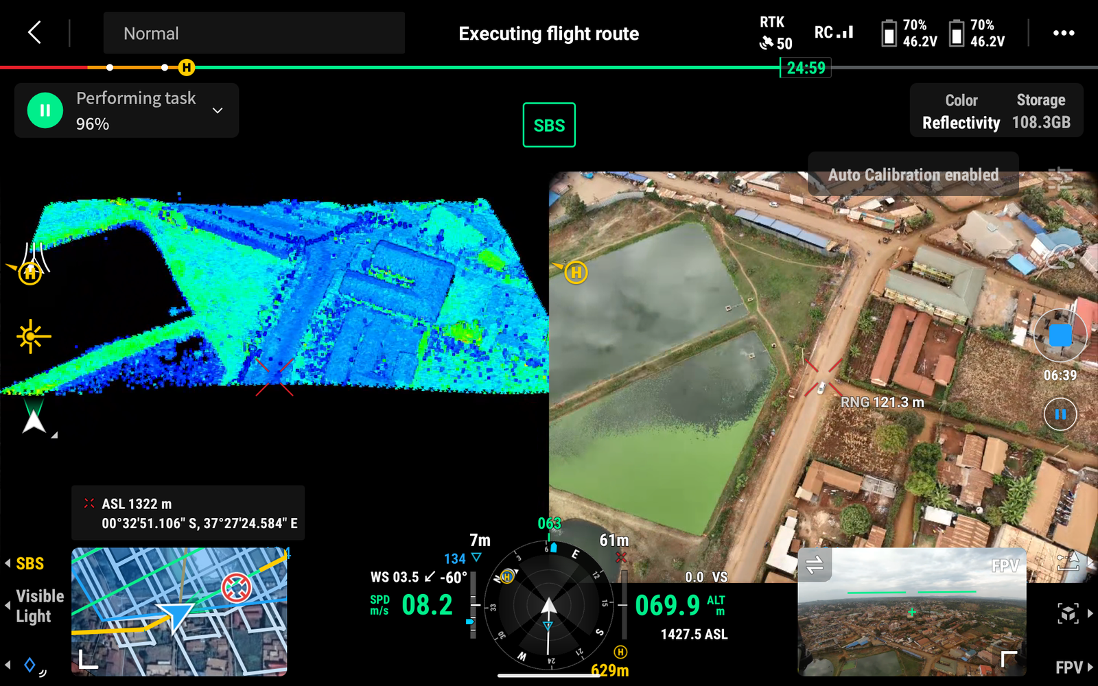
aerial data acquisition
Mapping
Whether you are looking for high-resolution topographical mapping, 3D modelling of landscapes or structures or land-use planning tailored to meet your specific project needs; look no further.
Precision Agriculture.
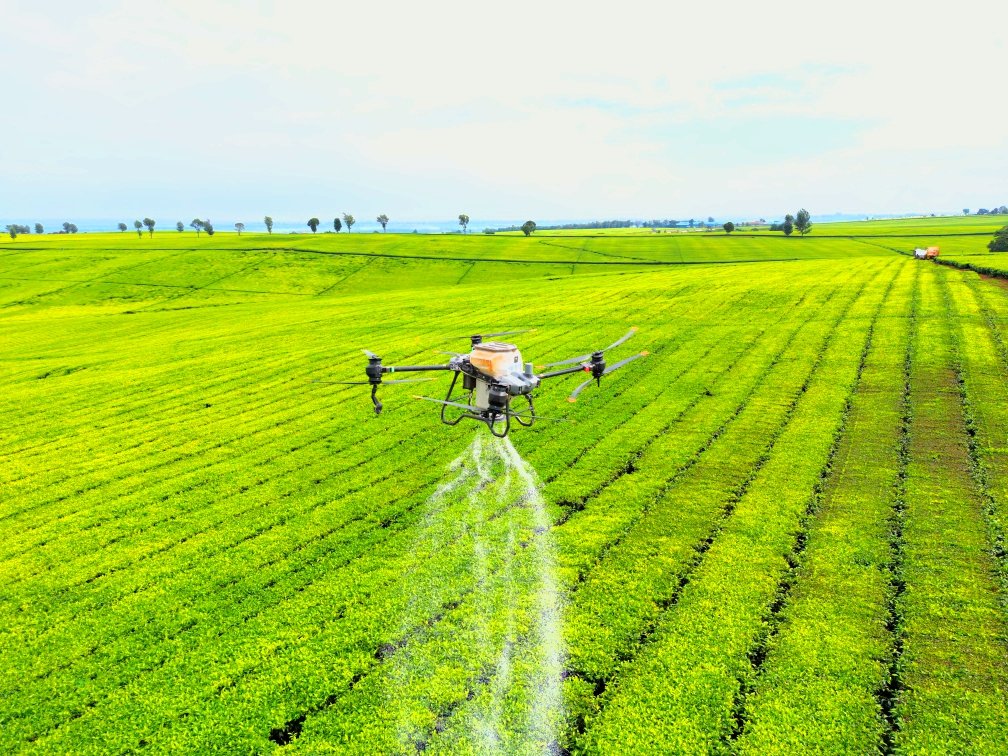
Aerial Spraying & Top Dressing
With our precision agriculture services, you can make data-driven decisions that reduce waste, cut costs, and improve overall farm productivity. From crop scouting and field mapping to plant counting and growth analysis, Vantage Vertical is your trusted partner in transforming agriculture through smart aerial technology.
Crop Monitoring
crop health
Detect issues early, reduce costs, and maximize yields with smarter farming from above.